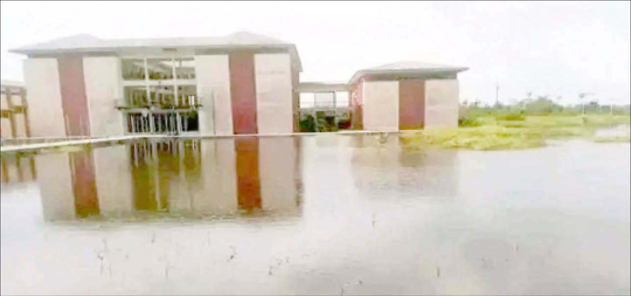
The National Emergency Management Agency (NEMA) recently said 19 states and 56 communities across Nigeria are likely to witness heavy rainfall in August.
The agency said the downpour can lead to flooding in the affected areas.
The affected areas, according to NEMA, include Aboh in Delta state, Ado-Ekiti, Akure, Idanre, Ifon, Iju Itaogbolu, Ogbese, Owo and Owena in Ondo state Apapa, Badagry, Eti Osa, Ikeja, Ikorodu, Ikoyi, Lagos Island, Ojo, Surulere, Atani in Anambra state, Ifo, Ota and Sagamu in Ogun state, Lafia and Wamba in Nasarawa state, Ikom and Ogoja in Cross River state.
Others include Jamaare, Misau, Azare, Itas, Kafin Madaki, Kari, Kirfi, Tafawa Balewa, Katagum in Bauchi state, Hadejia and Mige in Jigawa state, Ilesa and Osogbo in Osun state, Kosubosu in Kwara state.
- Partnership key to overcoming development challenges – BRICS Media Forum
- Buhari mourns soldiers killed in Niger
The rest are Anka, Bungudu and Gusau in Zamfara state, Goronyo in Sokoto state, Numan and Shelleng in Adamawa state, Serti in Taraba state, Ito, Katsina-Ala, Vande-Ikya in Benue state, Oguta and Orlu in Imo state and Ugba community in Abia state.
The agency and other government authorities have repeatedly advised people living in floodplains to temporarily relocate.
Notably, many of them have stuck to their guns, claiming they have nowhere to go. A number of landlords have also regretted buying properties in flood-prone areas. Daily Trust looks at five things prospective homeowners need to consider to avoid falling into this precarious situation.
Engineer Haris Ado of the Kano Ministry of works and Infrastructural Development listed flatness of land, quality of soil, flood zone, utility, and drainage system as the basic things to be considered before buying properties to avoid flooding.
Drainage System
Engineer Harisu Ado said drainage system survey is one of the primary things to consider before buying a property. He described the drainage system as an essential infrastructure to dispose of liquid waste, and get rid of human waste through a well arranged network of drainage pipes called a sewage system.
Flatness of land
He said the flatness of land is determined by a process called geomorphometric analysis.
“It measures the shape of the surface of the earth. This is done by looking at the horizon and measuring the rise of the land in comparison to the sea level. If the water table of the area is high, there is a huge risk of flooding,” he said.
Determine flood zone
The best way to prepare for flooding is to know how likely a flood may occur in your area.
Engineer Haris added that careful and effective land surveying can help determine if a specific property is in a flood zone.
He said that the first step to take is to check where the property lies, which is available on the Federal Emergency Management Agency’s (FEMA’s) flood maps.
Quality of Soil
He said quality of soil is one of the things any property buyer should consider to avoid risk of flooding.
He added that certain soil textures such as clay and silt are associated with low infiltration rates and result in rapid runoff during intense rainfall, which in the long run can lead to flooding.
Utility
He said any prospective property owner needs to do a utility survey. According to him, utility survey is an underground survey conducted to check for any below ground wiring or pipes to locate water, power, fibre optics, drainage, sewage, gas and telecommunications beneath the area where one wants to buy property.

 Join Daily Trust WhatsApp Community For Quick Access To News and Happenings Around You.


